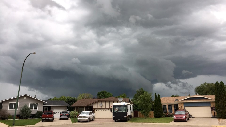
After several serious thunderstorms hit southeast Saskatchewan recently, producing a few minor tornadoes and bringing a lot of rain, it seems that the region is finally going to have a little break.
According to Environment Canada data, the temperature will go down a little bit towards the end of the week, with thermometers sitting a bit over 20C throughout the weekend.
After a couple of nice sunny days on Thursday and Friday, the last days of the week may seem greyish with a high chance of showers for Estevan starting Saturday night and continuing into Sunday.
The current forecast doesn't show any risks of thunderstorms in the nearest future. However, it turns out that it doesn’t mean Estevan will not get any.
“When we are going into a long-range forecast, past two days, day two… we wouldn’t put the chance of thundershowers in, we only put the chance of showers in,” explained Terri Lang, a meteorologist with Environment and Climate Change Canada. “You can assume that when there is a chance of showers in and around the summertime, there is usually a chance of thundershowers that goes along with that as well.”
The longer-range forecasts are generated by computers, which means that the data can significantly change when it comes to the 24-hour range.
“As we get closer in time human eyes look at (computer-generated data) and they can change them or adjust them accordingly to what the weather models are showing,” said Lang.
There are two models, short and long-range, and sometimes models can change quite a bit.
“The further you go out in time, the more uncertainty there is to the forecast,” said Lang.
Each shower and thundershower is an individual storm that comes along with a particular weather system.
“We can have a low-pressure system that moves through and sometimes we’ll get storms ahead of this low-pressure system, sometimes we’ll get some showers in behind that weather system as well. So it’s still the same weather system, but different parts of it,” said Lang.
One weather system moved through the Estevan area on Tuesday and Wednesday morning this week. Another one is approaching the Energy City and might cover this part of the province on the weekend.
The beginning of the next week again promises to be sunny and hot, with temperatures getting back closer to the 30C mark.
For weather forecast and extreme weather condition updates, check www.estevanmercuy.ca.


